Philadelphia Parks Embark on Pioneering Partnership with Google Trekker
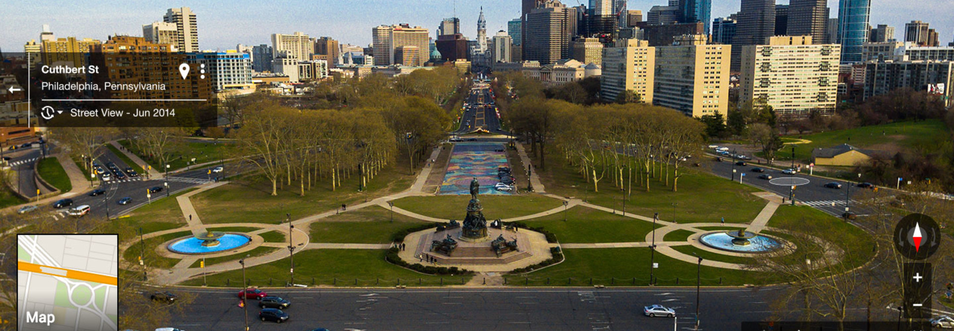
Philadelphia’s urban parks system is one of the largest in the country, and now the city has become the first major one in the U.S. to partner with Google to bring panoramic images of its beautiful trails to the web.
In May, two seasonal city employees began donning the Google Trekker, a 50-pound backpack equipped with a 15-lens camera that captures 360-degree images, and started hiking. Later this year, city officials say they will have photographed 223 miles of trails. Google will then take that data, edit it, and within a year post it on Google Street View.
“It’s not just a cool thing for citizens of Philadelphia — I think it’s a cool thing for everyone,” said Nora Dougherty, lead geographic information systems specialist for the city’s department of parks and recreation. “It grants virtual access to the parks to anyone. There are plenty of Philadelphians who haven’t been to a lot of our park system, so they can check out the park before they go there. But you can also check it out from the other side of the world. If you’re thinking about coming to Philadelphia and you want to see what there is to offer, you can click and see.”
Google Street View (which is part of Google Maps) provides panoramic views from streets all over the world. The images are captured by cameras primarily attached to cars, but trikes, snowmobiles and trolleys also are used. It is available in 77 countries, and in parts of the Arctic and Antarctica. The Trekker allows people to collect photos from more rugged places, like the Grand Canyon — and now, Philadelphia’s parks.
“It assists with our goal to create accurate maps, which play a significant role in building a local economy by making local businesses more accessible to both visitors and locals alike,” says Mara Harris, a spokesperson for Google Maps. “Imagery of parks and off-the-beaten-path locations allows visitors, locals and anyone from around the country and the world to see the natural wonders of a place and explore, either ahead of a visit or from afar.”
How the Trekker Project Got Started
The idea to map the city’s trails came from a colleague of Dougherty’s, who saw a Trekker demonstration at a conference in California when the device was new. After a lengthy application process, Google accepted the city’s proposal and loaned it a Trekker, which is operated through an app on an Android phone. Dougherty hired Conor Michaud and Philadelphia native Gint Stirbys to collect the images. Their progress has been quicker than she envisioned.
“We are ahead of schedule, which is not something that gets said in government very often,” she joked.
As they stroll through the city’s maintained trails (the project doesn’t include capturing images from unofficial, user-generated trails), Michaud and Stirbys attract interest from curious onlookers — and the occasional unleashed dog. But overall it’s been smooth sailing. The city also has used the Trekker to take shots of iconic nonpark Philly landmarks, such as the John Heinz National Wildlife Refuge and the Morris Arboretum of the University of Pennsylvania. Images of more of those types of places will be captured before the project ends.
“We’re having some major events here, like the Democratic National Convention,” Dougherty said. “The pope was here. We’re hoping that as people plan their stays in Philadelphia, they’ll check out our park system.”
Tourism boards, nonprofits, universities, research organizations and others can apply to borrow a Trekker pack. Google also recently started a small 360-degree camera loan program to encourage smaller organizations and individuals to contribute imagery to its maps, Harris said.
That Philadelphia’s was the first urban park system to partner with Google is a feather in the city’s cap, and could lead to other municipal and local governments utilizing the technology.
“I think it says that we think outside of the box a little bit,” Dougherty said. “We’re always trying to do new things here in the city — to find new ways to communicate with the public — and this is one of those ways. It’s another extension of us.”


