
Public Safety Agencies Deploy Drones for Surveillance
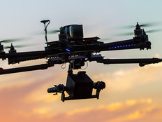
Locally, first responders such as police and fire departments are also launching drone programs to improve emergency outcomes. For example, the Lafayette Fire Department (LFD) uses three drones to enhance safety during hazardous material response and increase the efficiency of search and rescue operations.
Powerful cameras on the department’s DJI Matrices can zoom in on text up to one mile away, letting the LFD identify hazardous material containers at a safe distance after vehicle crashes or during commercial fires. Thermal imaging solutions, meanwhile, can quickly scan for heat signatures during search and rescue efforts, allowing the fire department to quickly eliminate large areas of forest or grassland from a search with minimal manpower.
The New York Police Department now uses drones to conduct collision and crime scene documentation, monitor traffic and assess primary and perimeter locations during hostage situations.
Feds Examine Ways Drones Could Hurt Critical Infrastructure
On the federal level, the U.S. Department of Homeland Security is keeping an eye on whether drones could harm critical infrastructure instead of protecting it.
According to a spokesperson for the Cybersecurity and Infrastructure Security Agency (CISA), most drone-related threats “are a result of hobbyists who are not fully aware of the laws that restrict overflight, particularly at critical infrastructure sites.”
To help combat this threat, CISA is using drones to simulate attacks on critical infrastructure and then record the results for debrief and analysis. The organization also highlights drone benefits in pinpointing locations for law enforcement response during attacks and aiding first responders during disasters.
The Federal Aviation Administration, for example, has made it simpler for agencies to use drones to assess the aftermath of emergencies; it’s created an expedited approval process for first responders and other emergency personnel who want to use drones during disaster situations, allowing them to fly in situations that are not normally permitted under FAA regulations.
Many Sectors Benefit from Drone Assessments
Other state-based drone deployments include:
- Air traffic control: Both North Carolina and Ohio are working on drone-based air traffic control systems that would help automate flight path routing and reduce the risk of airborne collisions.
- Avalanche mitigation: According to Government Fleet, the Utah Department of Transportation is using drones to analyze snow depth and avalanche hot spots, helping the agency identify high-risk sites and remotely trigger avalanches to increase overall safety.
- Precision agriculture: Kansas is using drone technology to underpin key economic infrastructure: Farming. Leveraging sensor-equipped drones to monitor soil temperature, humidity and irrigation levels, the Kansas Department of Transportation hopes to boost total crop yields.
Pearce notes that the NCDOT has no specific vendor for drone hardware. According to CISA, however, there is an increasing need for robust information security practices, as drones collect and store data about critical infrastructure and U.S. citizens. During their mock drone-attack exercises, for example, CISA conducted periodic audits to ensure no personally identifiable information was collected.
This speaks to the larger role of drones in the emerging Internet of Things: Just as government servers, databases and cloud resources must be secured across both access and activity vectors, aviation hardware must undergo the same scrutiny to ensure interoperational security and reduce the risk of data compromise, according to CISA.