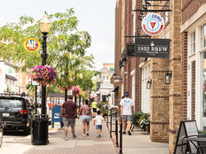

How Smart Cities Can Use Lidar to Protect Privacy
As state and local governments increase their use of publicly captured data for road and infrastructure use by citizens, demand for data protection and privacy is growing. Common concerns associated with smart city data use include the data collection itself, a lack of regulations for protecting the privacy of citizens, and the need for cities to adopt technologies that protect privacy and sensitive personal data.
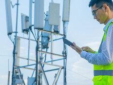
Lidar can be instrumental in helping governments address these privacy concerns, especially when compared with cameras, which is the perception technology most often used in smart city applications today.
Lidar can monitor civic environments and track pedestrians and vehicles while creating data about surroundings without collecting facial recognition or other biometric data. Lidar doesn’t require any interaction with a person’s cell phone, enabling it to accurately track people in crowded areas without invading personal devices. The technology provides the high-grade reliability needed for smart city solutions while preserving trust and anonymity among the public.
In comparison, camera-based monitoring systems capture individuals’ facial and other identifying information. Even when these systems are deployed for good, useful purposes, they are vulnerable to being accessed by unauthorized, potentially malicious entities.
EXPLORE: How are cities thinking about their smart mobility solutions?
Advancing Safety, Efficiency and Sustainability in Cities
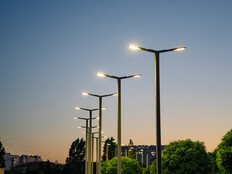
In addition to clear data privacy benefits, lidar is a foundational technology that can help drive intelligent mobility in smart city applications and in vehicles on our roadways. It can help improve pedestrian crossings on streets and enable better protection for children in school zones. Lidar can be a catalyst for smart city applications that improve public services and enhance safety and quality of life. It’s a technology that serves both citizens and municipalities by creating a secure and private future for a world in motion.
The societal and economic harm from motor vehicle crashes amounted to $871 billion in in the United States, according to a study released by the U.S. Department of Transportation’s National Highway Traffic Safety Administration. The human toll is also heavy, with a 2021 NHTSA study estimating that 38,680 people died in the U.S. in motor vehicle crashes in 2020.
Existing traffic sensors, including radar and camera, do not provide trajectory or 3D data, and camera performance struggles in low lighting and bad weather conditions. By comparison, lidar sensors with 360-degree-view capabilities are an attractive option because they capture 3D data of surrounding objects with high accuracy and frequency. Lidar sensors also can function in daylight and at night, and through conditions such as rain and snow.
RELATED: How can smart city tech improve community safety?
A University of Nevada, Reno, research team examined the feasibility of using roadside lidar sensors to provide high-accuracy, multimodal traffic trajectories by testing different sensors, deployment methods and traffic scenarios. They placed lidar sensors at crossing signs and intersections to help improve traffic analytics, congestion management and pedestrian safety.
The project found that roadside lidar data can enhance traffic mobility and safety analysis, support connected and autonomous vehicles, and integrate with traffic infrastructure for automatic pedestrian or wildlife warnings.
As a result, the research shows, these systems can help municipalities advance Vision Zero strategies, which have the goal to eliminate all traffic fatalities and severe injuries while increasing safe, healthy, equitable mobility for all.
They can also provide governments with the reliable, real-time traffic data needed to optimize traffic light timing to improve roadway flow based on congestion and throughput to enable more efficient, sustainable infrastructure.