How One City Used Tech to Tackle Eclipse Population Spikes

For many of us, preparing for the Aug. 21 total eclipse — the first to traverse the entire United States in hundreds of years — will mainly hinge on getting the right glasses and a good viewpoint. But for cities in the path of totality for the eclipse, preparing for the event, which will draw hundreds of thousands of sky-gazers within city limits, has proven to be an all-encompassing affair.
In fact, an estimated 1.85 to 7.4 million people will be traveling to the path of totality to view the eclipse. For cities along this path, rapid population influx will cause traffic jams and significant strains on emergency resources and infrastructure.
This will impact cities like Salem, Ore., which boasts a population of 165,000. As the first major city in the path of totality, it expects anywhere from 50,000 to half a million visitors to the city and its surrounding area during the event.
Gathering and Visualizing Data in a Busy City
A key to dealing with the influx will be understanding exactly what’s going on in the city. To do that, Salem is bolstering its existing geographic information system (GIS) infrastructure to support applications that can provide better situational awareness for city and county departments responding to crowds and incidents during the eclipse.
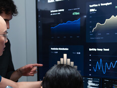
Salem will use its existing Esri ArcGIS platform, which provides mapping tools to create a common operational picture of the city, in order to collect data and offer real-time monitoring of traffic, citywide incidents, parks, events and resources. The goal is to use GIS to communicate data intelligence and awareness around the eclipse, which will allow the city to distribute resources appropriately and as needed, says Dan Brown, Salem’s GIS technical lead.
The city currently uses ArcGIS for city operations on on-premises servers. But for the eclipse applications, it will use a cloud-based online system in order to “track all the data going on in our region and stand up different applications to support our public works department, fire department, police department and public information office,” says Brown.
To gather this information, the city has put together the Eclipse Data Team, made up of employees from those departments.
The team members, alongside GIS professionals and subject-matter experts, will collect and report data, which will be combined with information from sources throughout the city, such as traffic cameras and crowdsourcing platforms. That data will go into a dashboard that will allow city employees to better visualize information such as traffic counts, patterns and accidents, the population of the city parks, and the status of the more than 70 eclipse-themed events happening in and around the city.
SIGN UP: Get more news from the StateTech newsletter in your inbox every two weeks
Laying the IT Groundwork for Better Real-Time Decisions
“We’re trying to come up with a real-time population by observing our parks and events by looking at the activity on our roads. We know the estimated population, but we want to try to capture the actual,” says Susan Blohm, IT supervisor for the city of Salem. She adds that while the city is tracking much of the information in real time, it is also incorporating hosted data feeds, such as weather or traffic, to supplement the picture.
“We also hook into the 911 system and the tracking of our emergency vehicles so we can get a complete picture of what’s going on out there,” says Blohm.
City leadership can then access this information to make better decisions and coordinate an appropriate response to crowds or incidents. Moreover, with unexpected road closures or other events likely, the ability to notify leadership and get information out to the public as soon as possible will help to ease travel woes.
And if there is an emergency event, GIS staff in departments around the city, such as the police, fire and public works departments, can help employees access and visualize information around the emergency to coordinate a more informed response.
“You can now leverage all of this data from photos, form-fills from the field, sensor data from traffic gauges, video data from traffic cameras or mobile devices, imagery from aerial platforms like drones,” says Chris McIntosh, director of national government industries at Esri. “The real beauty is that you can now leverage all of these as well as all of the Internet of Things and bring them into your environment, analyze them for trends or patterns and then display those trends or patterns to the responders that need to recognize that something is occurring.”
Using Existing IT to Scale Up Quickly
While Salem has been using GIS for government operations for more than 20 years, it only took about four to eight weeks to stand up the applications necessary to track and visualize the real-time data coming in around the eclipse. That’s because, while the eclipse is a unique event, the city already had the tools in place to scale up as necessary.
“The reason Salem is able to do this is not because they started planning for the eclipse, it’s because they have a program in place that looks to improve the resiliency of their community for all hazards,” says McIntosh.
And while daunting, tackling the eclipse has given the city the chance to take situational awareness and data use to the next level.
“The eclipse is an unprecedented event for the city in many ways, and it’s really given our team the opportunity to innovate and work out solutions to problems we have never faced before on this scale of magnitude,” says Kenny Larson, communications and community engagement manager for the city of Salem.